My Unforgettable Pacific Northwest Road Trip
For years, I had dreamed of an epic road trip up the West Coast to immerse myself in the raw beauty of this part of the U.S.
As a nature lover and outdoor enthusiast, scenes of towering redwoods, roaring Pacific coastlines, and mossy green rainforests had interested me for years. I decided 2024 would be the year I would finally make this trip a reality.
I mapped out my route, starting in the vibrant streets of San Francisco, with the iconic Golden Gate Bridge as the backdrop, then heading to Muir Woods’ magical giant redwoods to begin my retreat into nature’s peace and grandeur.
As a seasoned wedding photographer, I was eager to chase glowing golden hour light in some of Mother Nature’s most spectacular settings. Equipped with my camera gear, tripod, hiking boots, and a sense of wonder, I set off on my solo adventure feeling an exhilarating mix of excitement, joy, and possibility for what lay ahead on the open roads twisting along the gorgeous Pacific coast.
With my bags packed and my rental car loaded with my gear, this trip was finally becoming a reality. This was only the beginning of what would become an awesome journey of discovery, natural marvels, and adventure!

View of the Golden Gate Bridge from Baker Beach.
Pacific Northwest Road Trip – Muir Woods
I should point out that scheduling this trip in late January was intentional. I learned, from conversations on a previous trip to Oregon’s Willamette Valley, that the rainy season in winter would provide the kind of dramatic skies I was looking for in my images.
To prepare, I loaded up on Columbia Sportswear’s rain gear and Think Tank lens covers to keep myself and my camera gear dry.
My first stop was the astonishing, ancient Muir Woods. For any nature lover or hiking enthusiast like me, visiting the Bay Area wouldn’t be complete without hiking one of the last old-growth forests in the world. Walking among the towering redwoods, I was hypnotized by their majestic canopies hundreds of feet above.
The rain (pouring at times) created a sage forest scent, and perfect stillness filled me with a profound sense of peace. Although I missed the sight of spotted owls and bobcats, I lingered as long as I could, knowing this magical retreat would stay with me.


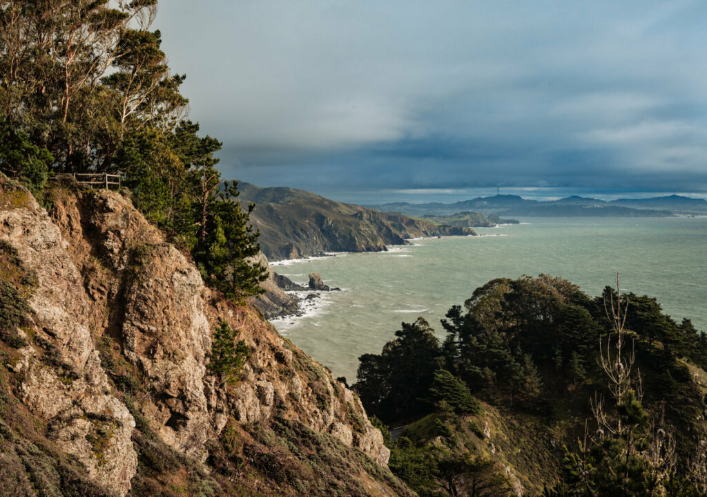
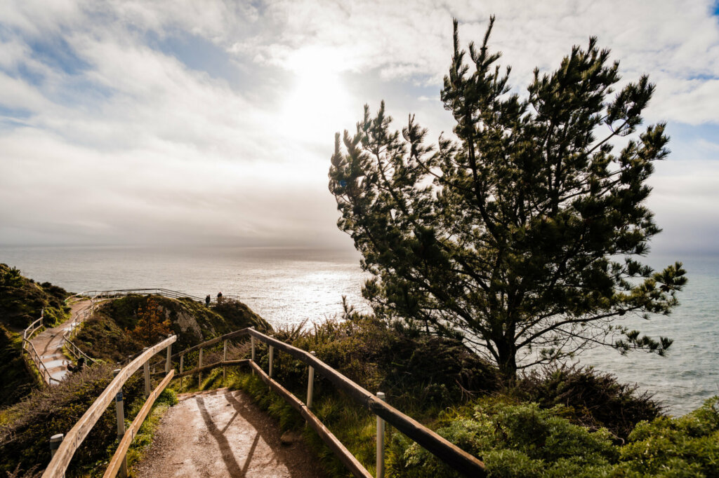
Pacific Northwest Road Trip – Muir Beach Overlook
Traveling up California Route 1 and not far from Muir Woods, you’ll find Muir Beach Overlook. This location offers spectacular views of the Pacific and rocky coastal cliffs, but bring a windbreaker! The steep stair trail out to the furthest lookout point is more than a little blustery, but well worth the view!
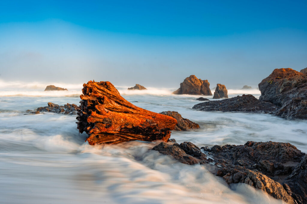
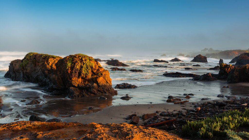
Pacific Northwest Road Trip – Fort Bragg, California
I was pleasantly surprised to discover the under-the-radar coastal town of Fort Bragg.
Logistically, it was about halfway between San Francisco and my next stop, Redwoods National Park. After a 170-mile drive from Muir Beach Overlook, it was a perfect location to spend the night.
The next morning, I woke up at 5 am to photograph the sunrise at a local coastal area before embarking on the 200-mile drive up the PCH to the entrance of Redwood NP.
I was rewarded by a gorgeous sunrise and watched in awe as the powerful Pacific Ocean crashed against the haystacks. It was a spectacular way to start the day!
Pacific Northwest Road Trip – Redwood National and State Parks
During my drive toward Crescent City and Redwoods NP, the sheer size and geographical diversity of our country’s 3rd-largest state really sank in.
In my 20-ish visits to California over the years, I had traveled between the border with Mexico in the south to as far north as Napa Valley. I knew there was still a large part of the state stretching north of Napa, but this was my first time experiencing it.
As I approached Redwood NP, I had already traveled almost 350 miles from my starting point in San Francisco. Being from the East Coast, we just don’t have anything to compare this to.
For example, as a New Jersey resident, that distance would take me from my NJ home through 5 states, with me enjoying a lobster roll in Maine 6 hours later. So, after a 3.5-hour drive, I was finally venturing into the heart of Redwood National Park.
I was dwarfed as I walked among the tallest, most ancient trees on Earth.
I stood speechless, gazing at their colossal trunks, wider than school buses! As fog crept between the giants, I felt their mystical energy – as if I’d stumbled into the realm of elves and sprites.
The moss-covered trees (a result of up to 80 inches of rain per year, thus making it a rainforest) reminded me of alien beings. I left knowing I’d barely scratched the surface of this magical kingdom.
Interesting Fact: Redwood National and State Parks comprise one national park and three California state parks (I thought it was one big park). The combined Parks contain Redwood National Park, Del Norte Coast Redwoods State Park, Jedediah Smith Redwoods State Park, and Prairie Creek Redwoods State Park. The parks’ 139,000 acres preserve 45% of all remaining old-growth coast redwood forests.


After the first day of exploring a couple of the Redwood National Parks, I spent the night in the town of Crescent City.
This small town is one of the northernmost in California, about 20 miles from the southwestern Oregon border.
It was a great spot to rest up after a couple of long days of driving, hiking, and shooting before I started my journey up the Oregon coast.

Battery Point Lighthouse in Crescent City, CA. The lighthouse dates back to 1856 and sits on an island accessible only by foot at low tide. The waves that I saw crashing around the island were dangerous and it was easy to see why this lighthouse is important to the local shipping community.
Pacific Northwest Road Trip – Oregon Coastline
It didn’t take long for the Oregon coastline to take my breath away with its wild, windswept drama. I first stopped along the Samuel H. Boardman Corridor at several different locations, followed by Otter Point State Park and Gold Beach, before stopping for the night in the charming town of Bandon.
All day, my view was filled with sheer cliffs plunging into the sea, waves smashing against the volcanic rock formations. I braced myself against the heavy winds/rain and salt spray…all my senses felt alive!
Photographing these locations was challenging due to my lack of experience with heavy winds, rain,/rain and aggressive waves common in the winter months of the coastal Pacific Northwest.
I learned a lot…quickly!


Pacific Northwest Road Trip – Oregon Sand Dunes
The Oregon Dunes are over 100,000 years old and stretch approximately 40 miles. The Dunes are the largest in North America and rise up to 500 feet in some areas.
I wasn’t aware of the Dunes until I kept seeing them from the Highway and finally stopped to take a look at one of the entrances. I wish I had known and planned to spend more time there.
You can rent off-road vehicles, go horseback riding, and camp, among other things.
Fun Fact: Frank Herbert’s science-fiction novel Dune was inspired (in part) by the author’s research on and fascination with the area.


The top picture was of a plateau I hiked to, with about a 100-foot elevation gain. The enormity of the dunes became apparent there…it was all the eye could see in all directions.
The couple in this photo, walking their dog, provides a bit of scale for this small piece of the Sand Dunes National Area. Much to my surprise, the bottom photo shows plant life somehow surviving in this sandy area.
Pacific Northwest Road Trip – Devil’s Churn
There’s something really beautiful, albeit scary, about the ocean in the winter…especially in the Pacific Northwest. Respect the sea at all times, but just in case you forget, the locals are kind enough to remind us visitors. I heard “don’t turn your back on the ocean” many times.
I learned what “sneaker waves” were and saw more than a few posted signs warning me that “serious injury or death by drowning” could occur if I got too close to the action. The problem with that is, if you’re a photographer and you want to create images with impact, you need to “get close to the action”.
One such place was the location below. I shouldn’t have been surprised that a place called “Devil’s Churn” might be a little dangerous. Most of the area is safe; you just have to use common sense. However, part of the area is a narrow inlet coming inland from the roaring Pacific.
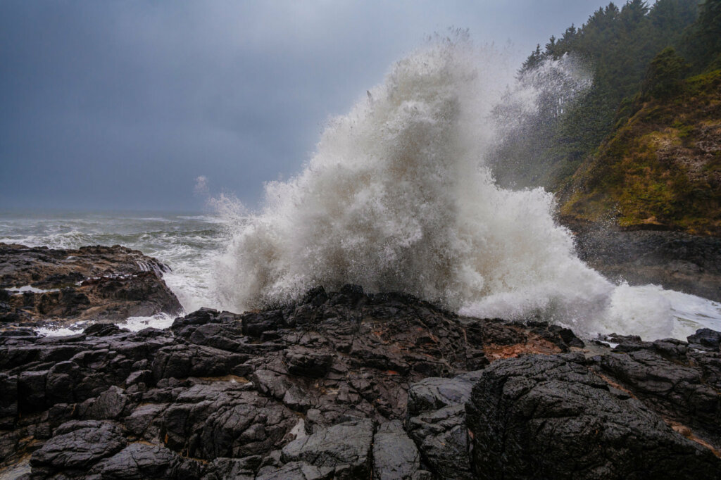
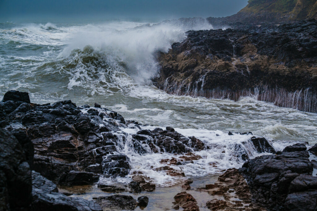
The more I looked at it, the more I thought that being at the end of the inlet and shooting towards the ocean would make for a nice shot.
The trick was getting out to that point with a 40-pound backpack on, in the rain, and knowing that if I slipped and fell into the inlet… well, thankfully that didn’t happen, and I got the shot!

The rocky ledge on the left side of this image (above) is what I had to use to get out to this shooting spot. It doesn’t look like much, but it was slippery and raining. Knowing that drowning would be the result of slipping and falling made this a little scary, to say the least.

Pacific Northwest Road Trip – Otter Rock & Yaquina Head Lighthouse
I spent the night at The Inn at Otter Crest, which I recommend if you stay in this area. While I was in the area, I visited the Yaquina Head Lighthouse and made sure to see the Devil’s Punchbowl before heading north.
One thing to note that I didn’t factor into my planning: If you want to see a water-based attraction (like Devil’s Punchbowl), make sure that you are there at the right time of day, i.e., high or low tide.
I missed a couple of opportunities to see some locations at their best because of this. Now I know!


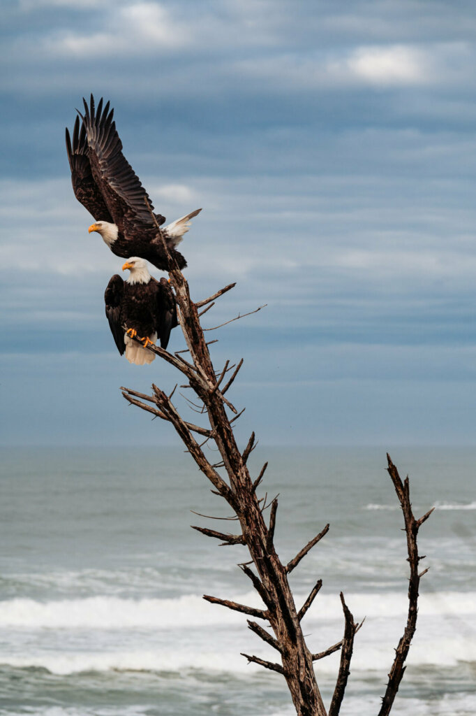
The first time I’ve ever seen an Eagle while traveling…so beautiful!

Devil’s Punchbowl in Otter Creek, Oregon.
Pacific Northwest Road Trip – Willamette Valley, Oregon
If you love Pinot Noir, you can head east from Otter Rock to the picturesque Willamette Valley for a day of great wine and food. Pinot Noirs that rival some of the great French labels can be had here, along with some amazing restaurants and inns to spend the night in before heading back to the coast and up to Washington.

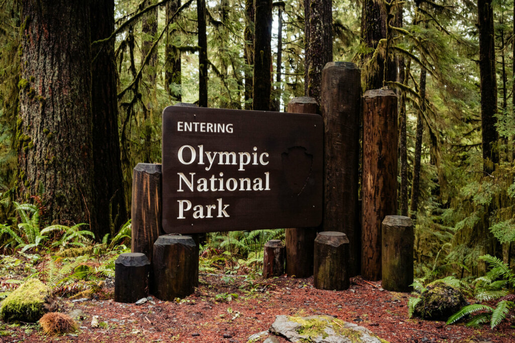
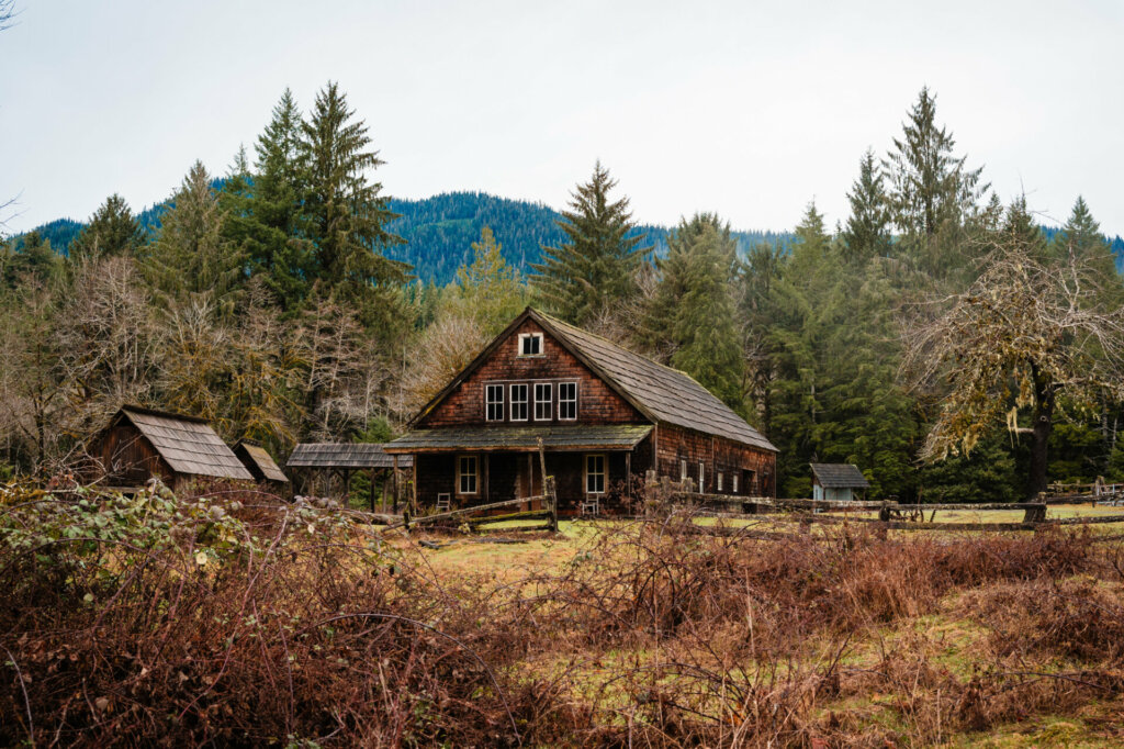
Pacific Northwest Road Trip – Olympic National Park, Washington
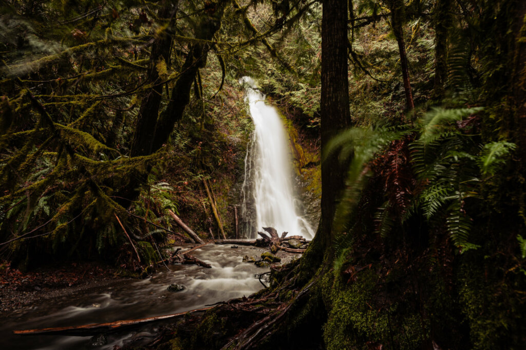
My last main stop and one that I had been anticipating for quite some time: the mossy rainforests and stunning beauty of Olympic National Park.
I was greeted by cascading waterfalls crashing into ancient ravines cloaked in emerald green.
Surrounded by 1,000-year-old cedar giants interwoven with sword ferns, I’d found an enchanted woodland kingdom of this UNESCO World Heritage Site.
Unlike my previous stops along this trip, I must admit that hiking miles into the forest alone got a little creepy at times. Signs at all the trailheads give you advice if a bear or mountain lion crosses your path, and also suggest that you “don’t hike alone”.
Maybe that was in my head a little as I walked for hours, hearing things scurry around in the forest all around me.
If that concerns you, you’d want to bring a companion for sure. I’m not exaggerating when I say that I would go many hours, sometimes a full day, without seeing another person.
I personally enjoyed that, for the most part, as my camera was my companion on this trip.
However, if I had been in an emergency situation (I was often miles away from my vehicle and another human), it wouldn’t have been ideal.
Fun Fact: There is little to no cell service in Olympic National Park, especially once you are in the forest.


Fun Fact: No one goes swimming in the ocean in this part of the country, not even in the summer months. Between the cold-water temps and the driftwood/tree hazards, going for a swim in the Pacific from Northern California through Oregon and Washington just isn’t a thing!
Pacific Northwest Road Trip – Hoh Rain Forest
The Hoh Rain Forest is a wonderland that will transport you to a primordial world of towering trees, lush vegetation, and an almost ethereal beauty.
As I ventured into this temperate rainforest, I was surrounded by a canopy of massive Sitka spruce, western hemlock, and Douglas fir trees that reached dizzying heights, filtering the occasional sunlight into a soft, green glow.
My visit here was truly a step back in time, offering a glimpse into one of the few remaining examples of the temperate rainforests that once blanketed much of the Pacific Northwest.


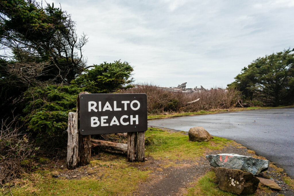
Pacific Northwest Road Trip – Rialto Beach
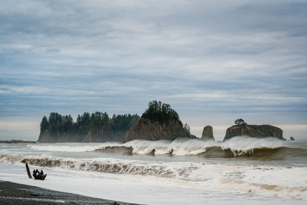
Nearby the Hoh Rain Forest, the secluded Rialto Beach offers a dramatic contrast to the rainforest. This rocky shoreline features giant driftwood logs strewn across the coarse sand like forsaken sculptures.
The real draw, however, is the majestic rock formations, known as sea stacks, that jut out of the pounding surf. Their presence is utterly breathtaking, inspiring me to wander along the beach and constantly framing new photographic perspectives of this unique location.
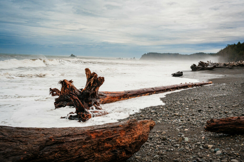
Interesting Fact: The logs that wash up on Rialto Beach and other parts of the PNW are massive in size and create a hazard for anyone getting close to the water.
Signs are posted at most beaches warning that logs in the water can kill if they strike someone. Many of the trees are 10 feet around and dozens of yards long, and are piled up like toothpicks at the back of the beach.
These logs were entire trees that had fallen into rivers and streams through erosion and storms and floated during flood times down to the ocean or directly into the ocean from the shoreline. The power of the sea is incredible!

I spent my final night in Port Angeles, Washington. It’s a small town that’s a gateway to Olympic National Park. Unlike many of the other towns I had stayed in during this trip, it has full-time residents and isn’t reliant on the busy summer season at Olympic N.P. I had plenty of restaurants and coffee shops to choose from, which was a welcome sight after a week of very few options.


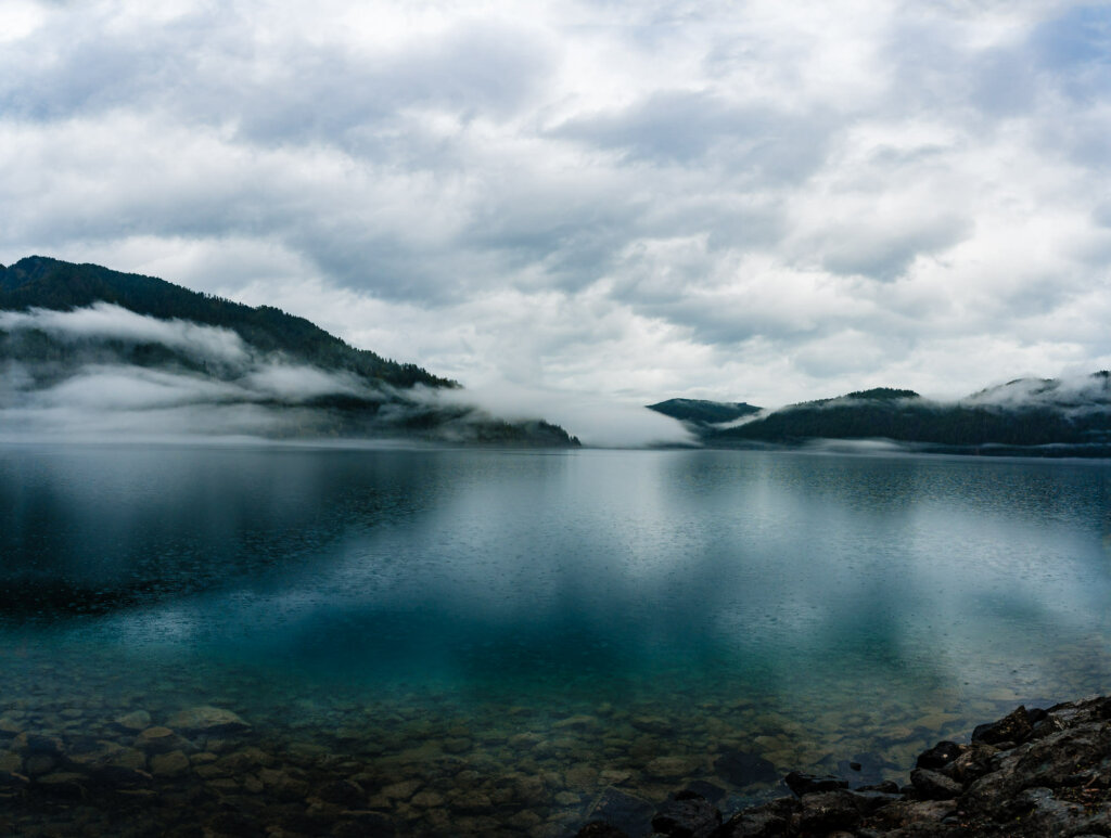
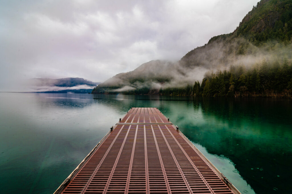
And this is where my 1,500-mile road trip ended before heading to Seattle and a red-eye flight back to Philadelphia. I just happened to stumble upon this dock at Lake Crescent, just 10 miles from Port Angeles, Washington.
It was rainy, foggy, moody, peaceful, and absolutely beautiful. Not a soul was around, and I found it the perfect place to wrap up this journey and head home.
Pacific Northwest Road Trip – Seattle, Washington
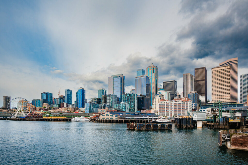
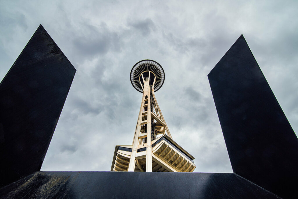
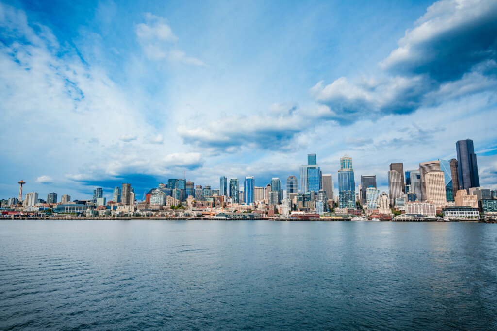
As I arrived in Seattle, I gazed back at the open road that had stitched together the highlights of my West Coast road trip. At some point during my dozens of hours in the car, it dawned on me that, over the years and culminating in this trip, I had traveled the entire length of the Pacific Coast Highway, from Baja California to Olympia, Washington. All 1,675 miles of it!
I felt renewed after witnessing Mother Nature’s masterpieces firsthand, for the most part with no one around. But most of all, I’d fallen completely in love with this slice of our spectacular planet, promising myself I’d be back to peel back more of its magical layers.
I highly recommend a Pacific Northwest road trip to anyone, especially those from other parts of the U.S. and abroad. You just won’t find anything like it where you live!
Join me on my next stop: Wyoming’s Grand Teton National Park.


